‘Unusually large’ multi-state storm causing severe weather for Australia’s east – with more on the way

Read the original at The Guardian ↗
Cite

Environment, G. R., & correspondent, c. (2026, October 25). ‘Unusually large’ multi-state storm causing severe weather for Australia’s east – with more on the way. The Guardian. https://www.theguardian.com/australia-news/2026/oct/25/unusual-multi-state-storm-causing-flood-warningd-and-severe-weather-for-australias-east

Dated from the outlet's own feed. Check the original for its byline.

The Guardian · collected 2026-10-25 · by Graham Readfearn Environment, climate correspondent

Quick Summary

A large-scale storm system is affecting eastern Australia, bringing severe thunderstorms and potential flooding to areas including southern Queensland and parts of New South Wales on Sunday and Monday. Wind gusts up to 100 km/h were recorded in western NSW, with hail, damaging winds, flash flooding, and power outages expected. Eight flood warnings are currently active across southern Queensland due to previous days of heavy rainfall. Bureau meteorologist David Crock attributes the severe weather to a persistent high-pressure system over the Tasman Sea that has been disrupted by a strong weather front moving in from the west.
Written locally by qwen2.5:14b on 2026-10-25, using this article's own text rather than the other coverage of the same event (that is the story summary below).

AI analysis runs on qwen2.5:14b, locally

Story summary

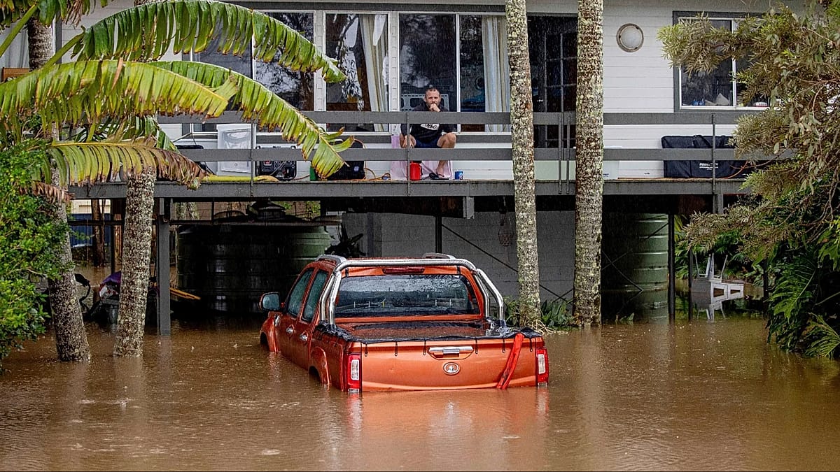
Large parts of eastern Australia were put on alert for severe thunderstorms on Sunday afternoon, with more potential storms and flood risks forecast for Monday. The Bureau of Meteorology reported that an unusually large multi-state storm system was causing severe weather across southern Queensland, western New South Wales, the ACT, and eastern Victoria. Already, eight flood warnings were in place across southern Queensland due to days of torrential rain, with some areas around the Sunshine Coast recording between 200mm and 400mm in just a week. Bureau meteorologist David Crock noted that an area of high pressure over the Tasman Sea had been blocking weather fronts for ten days, leading to storms and heavy rains in southern Queensland. Wind gusts up to 100km/h were recorded in central west NSW, with further thunderstorm warnings expected Sunday evening.
Written for “Large Multi State Storm Hits Australia” on 2026-10-25, grounded in this article and the 0 other(s) covering the same event.
Why this leaning score
This article does not take a side on a contested political question, so it has no leaning score. That is an answer rather than a gap: a match report or a rescue can be warmly or critically written without being left or right, and scoring it anyway is how approval of a subject gets recorded as a political position.
No political leaning scored for article 105339 · logged 2026-10-25

Story

📰 Large Multi State Storm Hits Australia
Environment · 1 article(s) covering the same event.

Compared with similar articles

This article reads unscored and hedges 11% of its claims. Each row says how that neighbour differs.
ABC News (AU)
⚖️ leaning not scored 🔴 0% hedged 0 of 4 📰 publisher trust 68
“The articles describe different time periods and focus on distinct weather events impacting various regions.”
ABC News (AU) · 0.88 cosine similarity
⚖️ leaning not scored 🔴 15% hedged 4 of 27 📰 publisher trust 68
“The articles describe severe weather events affecting different days in October 2026, with Article A covering a wider timeframe and regions than Article B which focuses on eastern Australia over the weekend.”
Euronews
⚖️ leaning not scored 🔴 5% hedged 1 of 20 📰 publisher trust 60
“The articles describe weather conditions spanning different dates and locations within Australia.”
ABC News (AU)
⚖️ leaning not scored 🔴 14% hedged 1 of 7 📰 publisher trust 68
“While both articles discuss severe weather conditions in Queensland and other parts of Australia on similar dates, they do not describe the exact same specific incident or time frame.”
The Sydney Morning Herald
⚖️ leaning not scored 🔴 5% hedged 1 of 19 📰 publisher trust 61
“The articles describe severe weather conditions in different regions of Australia but do not indicate they are reporting on the exact same incident or time.”
How this article was measured signals, leaning charts, publisher record, byline, topics and claims

Signals How these are calculated →

Claims extracted
18
sentences that state something as happening or true
Uncertain
11%
2 of 18 hedged ("reportedly", "may", "according to")
Leaning
not political
takes no side on a contested political question
Publisher signals
66/100
The Guardian's corrections and hedging, across everything collected from it. Not a measure of accuracy.
Outlets on this story
1
Environment
Same framing elsewhere
1
articles that frame the event the way this one does
Analyzed 2026-10-25 · how these are computed

How this is being covered How these are calculated →

Article leaning vs. publisher reliability
Source leaning vs. consistency

Publisher

The Guardian · 2407 article(s) · 6 correction(s) detected
Running correction rate · 6 correction(s)

Who wrote this

Graham Readfearn Environment
5 article(s) here · 1 carrying a prediction
🔮 Severe thunderstorms that could bring hail, damaging winds, flash flooding and power outages were likely over a huge area on Sunday afternoon, the bureau said, including across southern Queensland, western NSW, the ACT and eastern Victoria.
🔮 Alongside global warming, Grainger said the El Niño climate system that is still intensifying in the tropical Pacific – forecast to be the strongest ever recorded – had likely contributed to the heat and rainfall patterns seen in September.
🔮 On Wednesday, the commission said the greenhouse gas emissions from the mine, near Singleton, would “contribute to climate change impacts on the people, economy and environment of the Hunter region, NSW and globally”.
🔮 The biggest coal project before authorities in New South Wales, the HVO mine, will emit the equivalent of about 809m tonnes of climate-warming carbon dioxide if it wins approval.
🔮 Predictions in June that a building El Niño could combine with global heating for a challenging ski season came to pass, with seven resorts either already closed or announcing ski lifts will stop operating this weekend.
Also by Graham Readfearn Environment
Nothing else under this byline is closely related to this article, so these are simply their most recent.
climate correspondent
5 article(s) here · 1 carrying a prediction
🔮 Severe thunderstorms that could bring hail, damaging winds, flash flooding and power outages were likely over a huge area on Sunday afternoon, the bureau said, including across southern Queensland, western NSW, the ACT and eastern Victoria.
🔮 Alongside global warming, Grainger said the El Niño climate system that is still intensifying in the tropical Pacific – forecast to be the strongest ever recorded – had likely contributed to the heat and rainfall patterns seen in September.
🔮 On Wednesday, the commission said the greenhouse gas emissions from the mine, near Singleton, would “contribute to climate change impacts on the people, economy and environment of the Hunter region, NSW and globally”.
🔮 The biggest coal project before authorities in New South Wales, the HVO mine, will emit the equivalent of about 809m tonnes of climate-warming carbon dioxide if it wins approval.
🔮 Predictions in June that a building El Niño could combine with global heating for a challenging ski season came to pass, with seven resorts either already closed or announcing ski lifts will stop operating this weekend.
Also by climate correspondent
Nothing else under this byline is closely related to this article, so these are simply their most recent.

Topics

Australia NSW New South Wales Queensland The Bureau of Meteorology

Subjects

Queensland GPE · 8× Crock PERSON · 3× NSW GPE · 3× Australia GPE · 2× ACT GPE · 1× Canberra GPE · 1× David Crock PERSON · 1× New South Wales GPE · 1× The Bureau of Meteorology ORG · 1× Victoria GPE · 1×

Narrative

After a very dry September, southern parts of the state had seen October rainfall “multiple times their average” for the month, Crock said, with areas around the Sunshine Coast seeing between 200mm and 400mm of rain in the past week.
framing: assertive · carried by 1 article(s) · first seen 2026-10-25
🔮 Severe thunderstorms that could bring hail, damaging winds, flash flooding and power outages were likely over a huge area on Sunday afternoon, the bureau said, including across southern Queensland, western NSW, the ACT and eastern Victoria.

Claims (18 extracted, 2 hedged)

Large parts of eastern Australia were put on alert for severe thunderstorms on Sunday afternoon with more potential storms and flood risk in store for Monday. asserted
parts → put → Monday
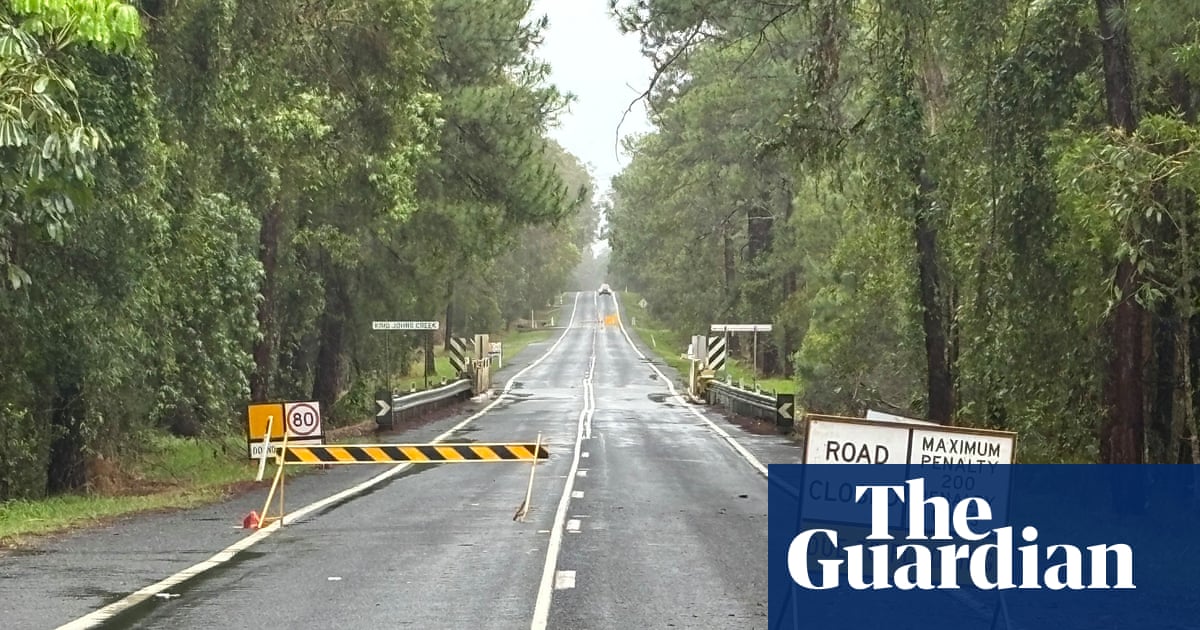
The Bureau of Meteorology said a broad line of storms had already swept through western New South Wales, while eight flood warnings were in place across southern Queensland after days of torrential rain. asserted
warnings → say → rain
Severe thunderstorms that could bring hail, damaging winds, flash flooding and power outages were likely over a huge area on Sunday afternoon, the bureau said, including across southern Queensland, western NSW, the ACT and eastern Victoria. uncertain
bureau → bring → Queensland
Wind gusts of up to 100km/h were recorded in the central west of NSW around midday on Sunday with the bureau warning residents of further likely thunderstorm warnings to come on Sunday evening. asserted
bureau → record → evening
“This is a multi-state system of storms and it’s unusually large,” said bureau meteorologist David Crock. asserted
Crock → ’ → storms
Crock said an area of high pressure had been sitting over the Tasman Sea for the past 10 days that had been blocking weather fronts and bringing storms and rains to southern Queensland. asserted
that → say → Queensland
“Eventually you get a strong enough system that pushes that blocking pattern away and that typically brings severe weather with it,” he said. asserted
he → get → it
A front of cooler air was moving from the west on Sunday afternoon, dragging in tropical moisture from the north and bringing storm conditions to central parts of NSW and to Canberra on Sunday afternoon. asserted
front → move → afternoon
“We have a big line of storms that’s extending all the way from the Snowy mountains to the Queensland border. asserted
that → have → border
Behind that we are watching to see if there’s going to another band developing behind it. asserted
we → watch → it
Storm activity was likely to continue through Sunday evening and into Monday in northern NSW and southern Queensland as the cold front continued to push. asserted
front → continue → NSW
“[Monday] is the last big bang of this system and that’s going to be a great relief for those people in south-east Queensland,” he said. asserted
he → go → Queensland
Southern parts of Queensland had been through a weather “whiplash” in the past week, Crock said. asserted
Crock → say → week
The Mary River downstream of Gympie was forecast to reach major flood levels in Tiaro on Sunday evening and into Monday. asserted
River → forecast → Monday
After a very dry September, southern parts of the state had seen October rainfall “multiple times their average” for the month, Crock said, with areas around the Sunshine Coast seeing between 200mm and 400mm of rain in the past week. asserted
areas → see → week
The bureau’s current long-range forecast for November to January suggests rainfall is likely to be above average over most of the country except the far north and much of Tasmania. uncertain
rainfall → suggest → Tasmania
November is likely to be warmer than usual for the southern half of the continent, with night-time temperatures in particular forecast to be likely well above average over most of the country. asserted
temperatures → forecast → country
Global heating has seen Australia warm by about 1.5C since 1910, the bureau’s long-term climate data shows. asserted
data → see → 1910
💬Give feedback
🕘History 🎫Support