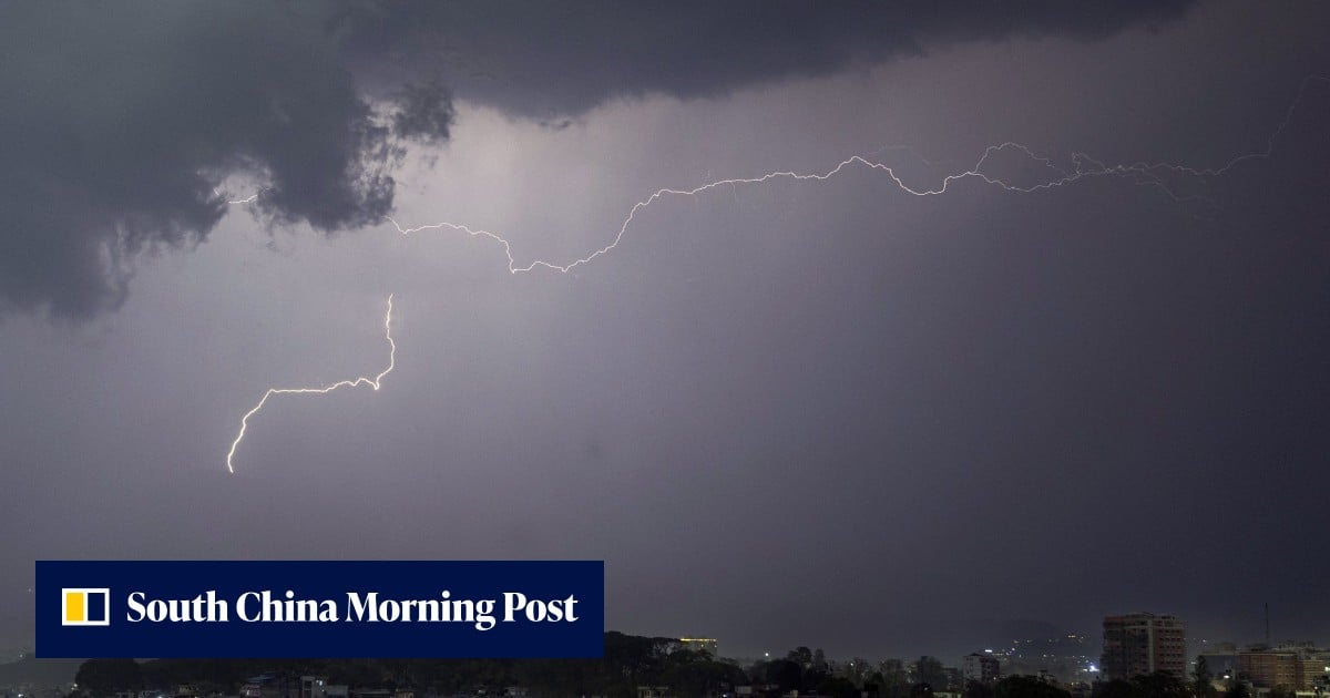
World’s most powerful lightning-chasing satellite joins China-Nepal flood relief efforts

News - South China Morning Post · collected 2026-09-06 · by Zhang Tong
Read the original at News - South China Morning Post ↗

Summary

China is using its Fengyun-4C satellite to aid Nepal's flood relief efforts by tracking severe thunderstorms with its powerful Lightning Mapping Imager (LMI). The LMI can process 30 gigabits of data per second and capture 500 frames of lightning activity per second, providing vital real-time information for search and rescue operations. The Fengyun-4C was launched in December and is positioned 36,000km above the equator, while another satellite, Fengyun-3G, provides additional weather data. The Chinese government set up a cross-border emergency monitoring system using this technology after a glacier collapse on August 26.
Written by the local model on 2026-09-06, using this article's own text rather than the other coverage of the same event (that is the story summary below).

Signals How these are calculated →

Claims extracted
8
claim-shaped sentences
Uncertain
38%
3 of 8 hedged
Leaning
not political
takes no side on a contested political question
Publisher trust
94.0
red-flag proxy, not a credibility rating
Outlets on this story
1
Technology
Narrative spread
1
articles carrying this framing
Analyzed 2026-09-06 · how these are computed

AI analysis (generated at analysis time, not now)

Story summary

China has deployed its powerful geostationary weather satellite, The Fengyun-4C, to aid in flood relief efforts following last month's devastating glacier collapse in Nepal. The satellite, launched in December and positioned 36,000km above the equator, carries a Lightning Mapping Imager that captures 500 frames per second of data, including individual lightning strokes, equivalent to processing 30 gigabits of data every second. This technology provides real-time intelligence for search and rescue operations, which began after the disaster on August 26. China has set up a cross-border emergency monitoring observation mechanism in response to the crisis, leveraging the satellite's capabilities to track severe thunderstorms over Nepal.

Written for “China Nepal Flood Relief Efforts” on 2026-09-07, grounded in this article and the 0 other(s) covering the same event.
Why this leaning score
This article does not take a side on a contested political question, so it has no leaning score. That is an answer rather than a gap: a match report or a rescue can be warmly or critically written without being left or right, and scoring it anyway is how approval of a subject gets recorded as a political position.
No political leaning scored for article 5369 · logged 2026-09-06

Story

📰 China Nepal Flood Relief Efforts
Technology · 1 article(s) covering the same event. This is the one the site leads with.

How this is being covered How these are calculated →

Article leaning vs. publisher reliability
Source leaning vs. consistency

Compared with similar articles

This article reads unscored and hedges 38% of its claims. Each row says how that neighbour differs.
News - South China Morning Post
⚖️ leaning not scored 🔴 10% hedged 1 of 10 📰 publisher trust 94
“The articles describe different events: one is about China launching a plan for a 3D satellite network to monitor sun and cosmic explosions, while the other is about a satellite (Fengyun-4C) being used in flood relief efforts over Nepal.”

Publisher

News - South China Morning Post · 156 article(s) · 0 correction(s) detected
SignalValueWeight
Correction rate 0.000 0.4
Uncertainty density 0.120 0.25
Assertive mismatch rate 0.000 0.35
No corrections detected for this publisher. That may mean careful reporting, or simply that nothing has been checked.

Who wrote this

Zhang Tong
4 article(s) here · 1 carrying a prediction
🔮 State broadcaster CCTV reported that the technology could fundamentally strengthen China’s ability to secure its own iron resources and reduce its heavy dependence on imports of the strategic commodity.
🔮 The Fengyun-4C’s storm-tracking abilities could provide vital early warnings about extreme weather events during the rescue operation China is using the world’s most powerful geostationary weather satellite to track severe thunderstorms over Nepal and deliver real-time intelligence as the two countries continue search and rescue operations following last month’s devastating glacier collapse.
🔮 By tracking the needle’s tiny deflections, the team can measure magnetic fields down to the femtotesla level – an advance that could widen the hunt for elusive dark matter particles or monitor brain signals.
Also by Zhang Tong
Nothing else under this byline is closely related to this article, so these are simply their most recent.

Topics

Beijing China Nepal The Fengyun-4C’s a Lightning Mapping Imager

Subjects

China GPE · 2× Beijing GPE · 1× Nepal GPE · 1× Xinhua ORG · 1×

Narrative

The Fengyun‑4C satellite – launched last December and now positioned 36,000km (22,000 miles) above the equator – carries a Lightning Mapping Imager (LMI) that captures 500 frames per second, sifting through 30 gigabits of data every second to pinpoint individual lightning strokes.
framing: mixed · carried by 1 article(s) · first seen 2026-09-06
🔮 The Fengyun-4C’s storm-tracking abilities could provide vital early warnings about extreme weather events during the rescue operation China is using the world’s most powerful geostationary weather satellite to track severe thunderstorms over Nepal and deliver real-time intelligence as the two countries continue search and rescue operations following last month’s devastating glacier collapse.
2026-09-06 · News - South China Morning Post
World’s most powerful lightning-chasing satellite joins China-Nepal flood relief efforts · mixed framing

Claims (8 extracted, 3 hedged)

World’s most powerful lightning-chasing satellite joins China-Nepal flood relief efforts asserted
satellite → chase → efforts
The Fengyun-4C’s storm-tracking abilities could provide vital early warnings about extreme weather events during the rescue operation China is using the world’s most powerful geostationary weather satellite to track severe thunderstorms over Nepal and deliver real-time intelligence as the two countries continue search and rescue operations following last month’s devastating glacier collapse. uncertain
countries → track → collapse
The Fengyun‑4C satellite – launched last December and now positioned 36,000km (22,000 miles) above the equator – carries a Lightning Mapping Imager (LMI) that captures 500 frames per second, sifting through 30 gigabits of data every second to pinpoint individual lightning strokes. asserted
that → launch → strokes
That processing power, engineers say, is equivalent to playing 30 high-definition films a second and spotting every traffic light in each one. asserted
engineers → say → one
In the hours after the glacier disaster struck on August 26, Beijing set up a cross-border emergency monitoring observation mechanism, according to state news agency Xinhua. uncertain
Beijing → strike → Xinhua
At the core of that response is the LMI’s continuous animation, which gives meteorologists a sharp, frame‑by‑frame view of lightning activity inside severe storms. asserted
which → give → storms
Combined with the Fengyun‑4C series’ cloud animations, convective initiation data, rainfall estimates and precipitation measurements from the Fengyun‑3G satellite, the system allows forecasters to track regional rainfall and weather changes in real time. asserted
forecasters → combine → time
As the most obvious sign of extreme weather, lightning can reveal where storms are intensifying, how fast they are moving and when they might unleash flash floods, landslides or destructive winds. uncertain
they → reveal → floods
💬 Give feedback
🕘 History 🎫 Support