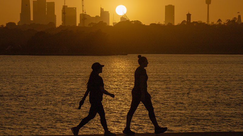
Summer heat is due to arrive early across much of eastern Australia with potentially record early September temperatures predicted for Brisbane and Sydney, while snow was expected in southern New South Wales.
asserted
snow → arrive → Wales
Maximum temperatures in Sydney during the first days of September were on track to match the city’s midsummer average of 26.4C, warmer than any other start to spring since the city’s Observatory Hill station opened in 1858.
asserted
station → match → 1858
Suburbs across Sydney were expected to reach up to 33C on Saturday afternoon, smashing average September records by up to 13C.
The temperature in Badgerys Creek reached 33C shortly before 2pm, while Observatory Hill hit 32.1C a short time later.
asserted
Hill → expect → 32.1C
The meteorologist Tom Saunders said a gusty north-westerly airstream blowing south from the northern interior would lift maximums this weekend by as much as 13C above the average.
asserted
airstream → say → average
The highest anomalies were set to affect the NSW coast.
asserted
anomalies → set → coast
“For Sydney, it’s likely to be the hottest day this early in spring on record and for the first five days of September we’re on track to average a top of 27 degrees that matches the midsummer average,” he told ABC News.
asserted
he → ’ → News
“Temperatures this spring will average as much as three degrees above the baseline from recent decades, potentially the hottest spring on record.”
asserted
Temperatures → average → record
The warm, dry and windy conditions would cause fire dangers to spike.
asserted
dangers → cause → ?
A total fire ban was in place for the greater Sydney region, where extreme fire danger was forecast.
asserted
danger → forecast → region
The dramatic – and potentially dangerous – start to Australia’s spring extended across much of the continent, with damaging winds that could bring down trees and roofs in South Australia, and minor to moderate flooding for parts of Victoria and Tasmania.
uncertain
that → extend → Victoria
Meanwhile, in southern NSW, live cameras appeared to show snow falling late on Saturday morning in Thredbo in the Snowy Mountains.
asserted
snow → appear → Mountains
The Bureau of Meteorology had forecast snowfall to hit Thredbo top station by 4pm on Saturday, with a daytime low temperature of -1C.
The new falls won’t do much to help the parlous cover remaining on Australia’s ski fields after a warm winter, however.
The Weatherzone journalist Anthony Sharwood on Friday wrote: “September snowfalls are meaningful when there’s a decent remnant snowpack from winter onto which the new snow can bond.
asserted
snow → forecast → which
Across the border, southern Queensland would see temperatures peak in the mid-30s in another unseasonably warm start to September.
asserted
temperatures → see → September
Heavy rains were forecast for north-east Victoria and northern Tasmania, with up to 60mm expected in some parts.
asserted
mm → forecast → parts
“The catchments in those areas are really wet,” the BoM meteorologist David Crock said on Friday.
asserted
meteorologist → say → Friday
“They’ve seen multiple rounds of flood warnings this winter already.
asserted
They → see → warnings
“So we’ve got a flood watch current again for these catchments across northern Victoria … and across parts of northern Tasmania as well.”
asserted
watch → get → Tasmania
The dramatic start to spring comes against the background of a “supersized” El Niño weather phenomenon to Australia’s east, one that is already breaking heat records, and could comfortably surpass previous events.
uncertain
that → come → events
On Thursday, the UN’s weather agency said the event in the Pacific was continuing to strengthen and would probably persist until early 2027, warning it had the “potential to deliver a massive blow to communities and economies across the world”.
asserted
it → say → world
El Niño events tend to mean hotter and drier conditions for Australia’s south and east in winter and spring, and can increase the risk of heatwaves, drought and bushfires.
asserted
events → tend → heatwaves
Australia’s national council for fire and emergency services said fire authorities were predicting a heightened risk of fire across northern and south-eastern NSW, south-east Queensland, north-eastern Tasmania, parts of Western Australia, South Australia and Victoria, and large parts of the Northern Territory.
asserted
authorities → say → Territory
 The Aporia